From Sky: How SURF-IT is Introducing UAV Technology in Coastal Embankment Mapping
/
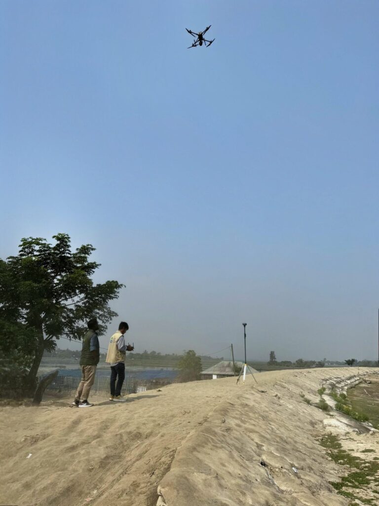
The unforgiving coastal landscapes of southwest Bangladesh are constantly battered by natural disasters, leaving embankments vulnerable and communities at risk. For years, ACF, North South University and grassroots organization like Uttaran has been working tirelessly to enhance climate adaptation and disaster preparedness. Now, with the adoption of cutting-edge drone technology, the SURF-IT project is setting a new benchmark in data-driven decision-making. Equipped with the DJI Matrice 350 RTK and Zenmuse L2 LiDAR, the organization is introducing how embankments are mapped, monitored, and protected. Through the SURF-IT project, young professionals are being trained in UAV operations, ensuring sustainable expertise in geospatial intelligence. Additionally, this innovative approach is set to address the persistent challenge of tidal surges, which frequently breach weak embankments and cause widespread devastation. Unlike major cyclones, these surges occur year-round, leading to long-term livelihood and infrastructure damage. To fill this gap, the project is leveraging UAV technology to map embankments systematically, identify weak zones, and enhance disaster preparedness.
Embracing UAV Technology:
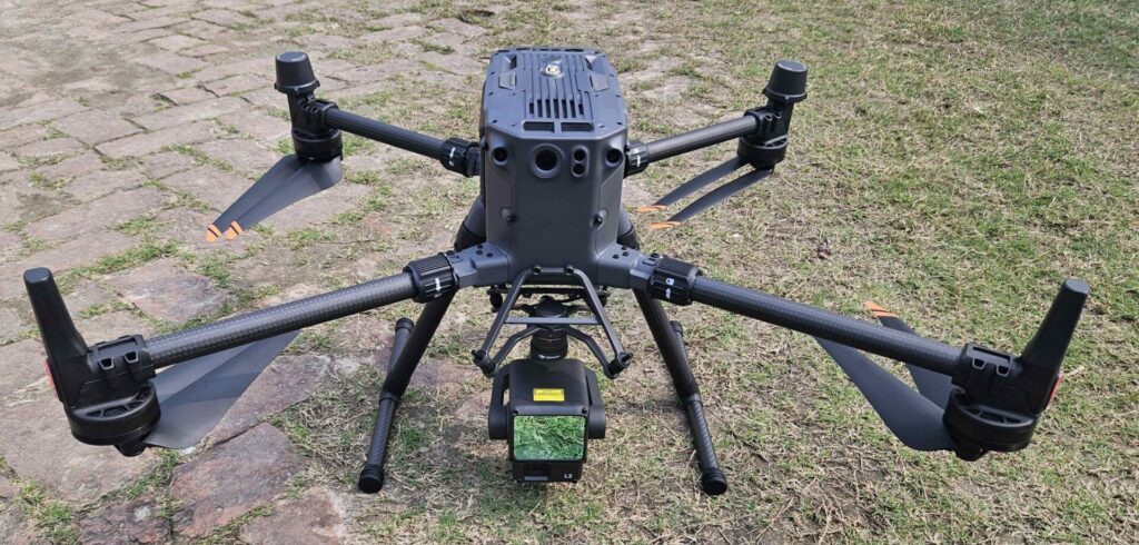
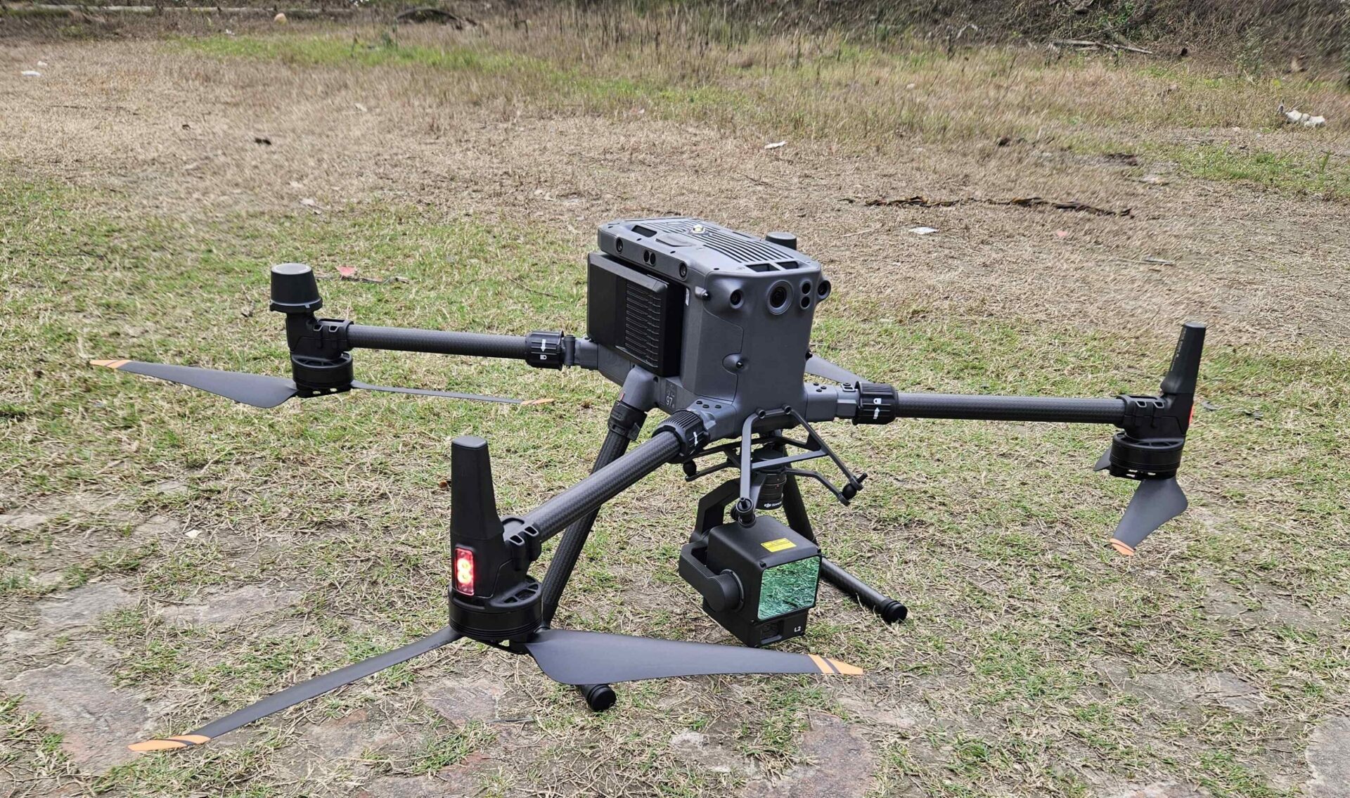
At the heart of this initiative is the DJI Matrice 350 RTK, a powerful drone designed for precision mapping and harsh environmental conditions. With an extended flight time of up to 55 minutes, this UAV covers vast areas in a single mission, capturing critical data with centimeter-level accuracy through RTK positioning. Its rugged design ensures that operations continue uninterrupted, even in extreme weather. However, the real game-changer lies in its ability to support multiple payloads, allowing it to carry Zenmuse L2 LiDAR—a cutting-edge sensor that unlocks unparalleled high-resolution terrain data. The Zenmuse L2 LiDAR brings a new dimension to embankment monitoring, capturing up to 240,000 points per second to generate detailed Digital Elevation Models (DEMs) and orthophotos. These datasets provide a crystal-clear view of ground elevation, embankment vulnerabilities, and flood-prone areas with an accuracy of 2 cm vertically and 4 cm horizontally. The seamless integration within the DJI ecosystem ensures smooth operations, enabling Uttaran’s research team to quickly process and analyze data.
Building Local Expertise:
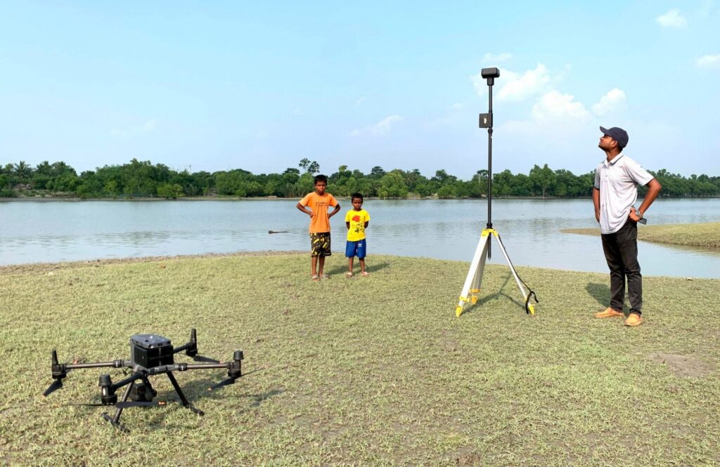
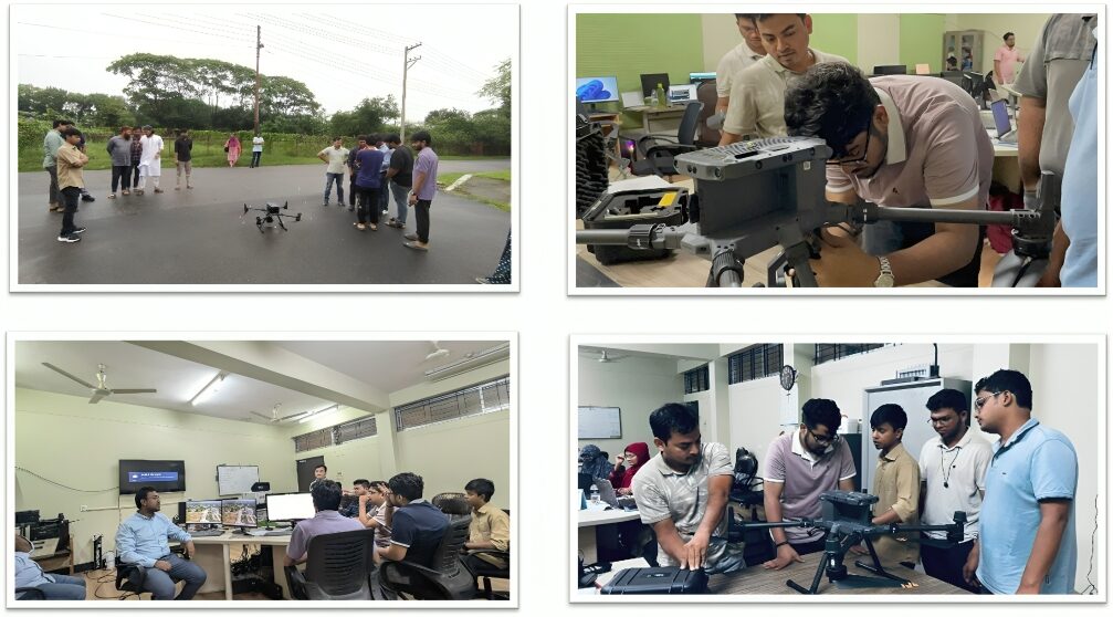
Recognizing that technology alone is not enough, Uttaran, ACF and North South University under the SURF-IT project, has launched an ambitious in-house UAV training program to build local expertise. With limited skilled manpower in the field of drone operations and geospatial data analysis, the initiative focuses on equipping young professionals from North South University (NSU) and Uttaran with the necessary skills to conduct aerial surveys and process complex geospatial data. Over four intensive days, participants learned to assemble and install drones, plan optimized flight paths, and troubleshoot technical challenges in the field. The training emphasized the operation of the Matrice 350 RTK with Zenmuse L2 LiDAR, ensuring that the research team could effectively plan and execute UAV-based surveys. This hands-on experience has already yielded success, with drone surveys completed across two out of three targeted sub-districts, significantly improving the team’s ability to collect and interpret critical data.
A Future Built on Data-Driven Decisions
By integrating drone-based mapping with ground truth data collection, the project is setting a new standard in vulnerable embankment monitoring. With over 250 accurately measured elevation points, the project ensures that it’s processed LiDAR datasets are rigorously field-validated, minimizing errors and maximizing reliability. This technology-driven approach is already making a tangible difference. For the first time, drone mapping is identifying weak points in the embankments before disasters strike, enabling targeted reinforcements. By leveraging DJI Matrice 350 RTK, Zenmuse L2 LiDAR, and AI-enhanced forecasting, the project is introducing embankment monitoring and early warning systems in southwest Bangladesh. Through the SURF-IT project, the organization is not only strengthening local expertise but also setting a national example for how grassroots organizations can harness cutting-edge technology to protect vulnerable communities. As the effects of climate change continue to intensify, the need for innovative solutions grows ever more urgent. By embracing UAV technology, the project is not only protecting Bangladesh’s coastal communities but also pioneering a data-driven future where science, technology, and local expertise come together to safeguard lives and livelihoods.
Future of Coastal Embankment Mapping
Categories
Countries
CLARE Pillars
CLARE Themes
CLARE Topics
Published
CLARE Projects
CLARE Partners