Watersheds and Workshops: The Science of Community Resilience
/
Effective solutions start with a shift in perspective: recognizing that vulnerability isn’t a blanket issue, but a shifting landscape of unique hazards that must be mapped community by community.
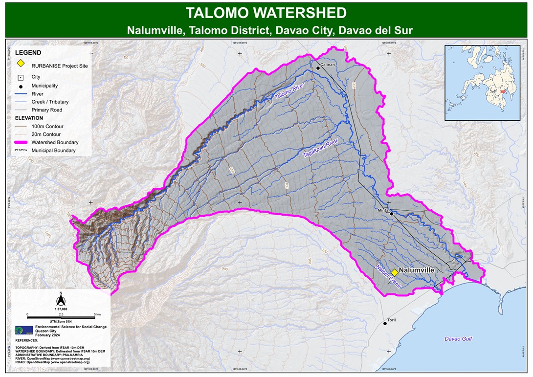
Urban flooding is not a uniform hazard. From the industrial corridors of the ULHOA community in Valenzuela to the Nalumville community that lies within bends of multiple creeks in Davao City, every community contends with a highly localized set of risks. Project RURBANISE addresses this by integrating the results of aerial survey mapping that uses drone technology and geohazard data with lived experiences of community members through participatory workshops, capturing vulnerability from both 100 meters above and directly on the ground.
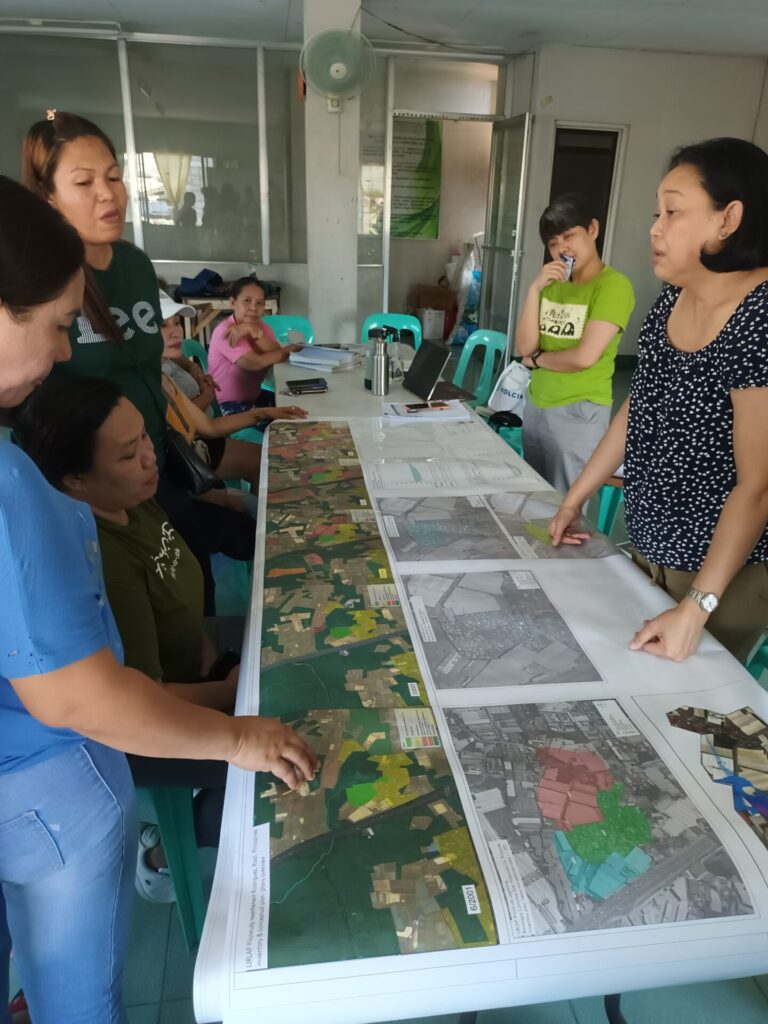
From April to August 2024, the Environmental Science for Social Change (ESSC) spearheaded the Community Vulnerability and Capacity Assessment (CVCA) workshops across seven RURBANISE project sites. These participatory sessions empowered Homeowners Associations (HOAs) to review and assess their exposure and vulnerabilities to hazards and their adaptive responses. The resulting report captures a narrative of ‘common but differentiated‘ resilience.
The Methodology: Merging Science with Lived Experiences
Building resilience moves beyond reading a map, but also understanding the real stories behind it. The CVCA workshops followed a four-step process:
1. Development of HOA Fact Sheets
The partner HOAs were profiled based on their location, history and background, membership, land tenure status, relationship with local governments, and social and environmental concerns.
A critical feature of the HOA fact sheets is the identification of the watershed where the HOA is located, thus providing an understanding of the broader hydrological context. With this, the fact sheets illustrate how land-use changes in upland areas—such as deforestation or increased urbanization—exacerbate flooding in downstream floodplains.

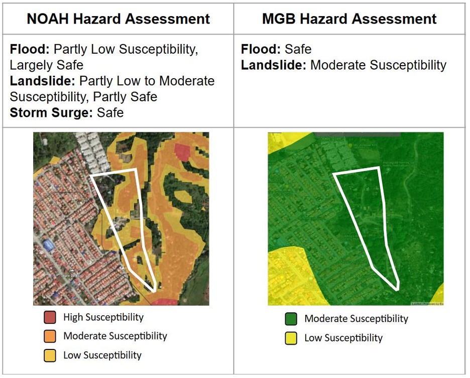
Geohazard data from the Mines and Geosciences Bureau (MGB) of the Department of Environment and Natural Resources (DENR) and from the Nationwide Operational Assessment of Hazards (NOAH) of the University of the Philippines (UP) were obtained for the specific HOA locations. These provided the hazard information such as flooding, landslides, and storm surges in each partner community.
2. Pre-Workshop Meetings
The team held pre-workshop consultations with HOA leaders to ensure that the objectives are understood and clarified,and that there is participation from the HOA and representatives from local government, apart from finalizing logistics and ensuring the workshop fits the each community’s schedule.
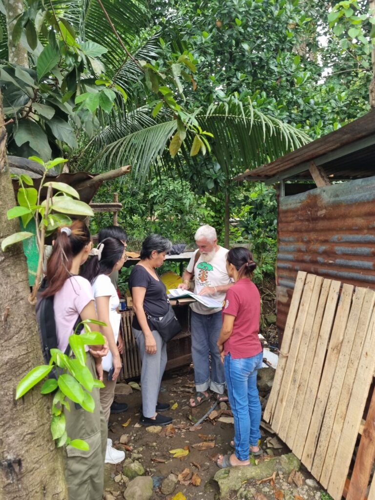
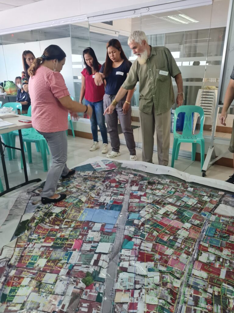
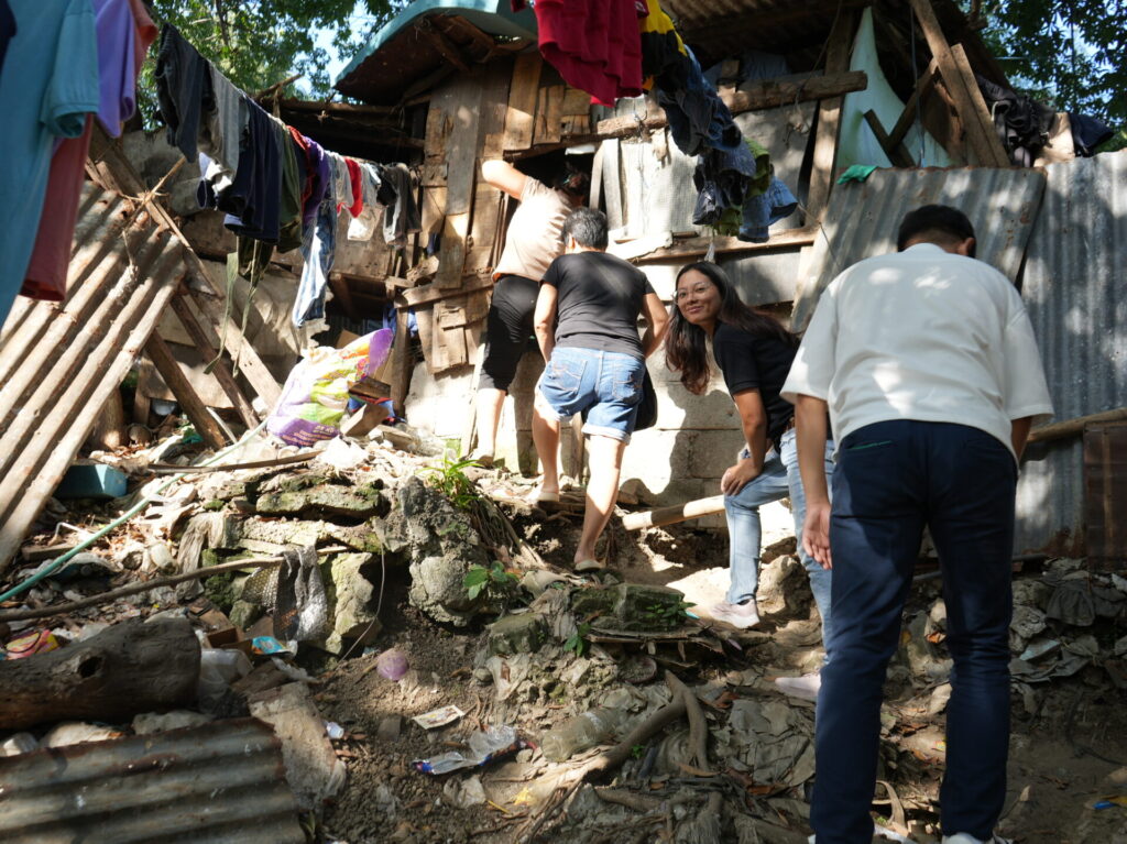
3. Transect Walks
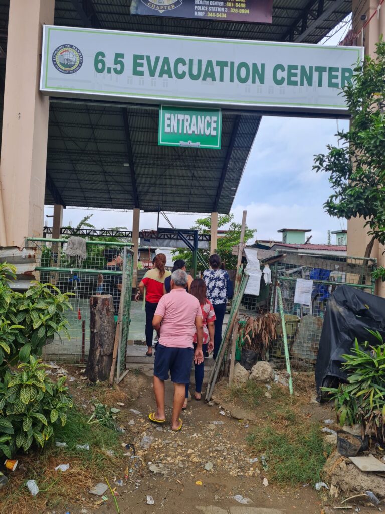
The assessment began with a community-led transect walk, providing an essential firsthand look at the local environment. The transect walk is a participatory, systematic tool where researchers and community members walk together along a defined path across an area to observe, ask questions, and document local conditions, resources, and challenges. It is used to quickly gain spatial understanding, verify data, and build rapport with community. The transect walks are part of the CVCA process and provide an opportunity to closely view identified community concerns such as frequently flooded areas in the community, blocked drainage canals and waterways due to garbage, at-risk housing, evacuation centers, and other infrastructure.
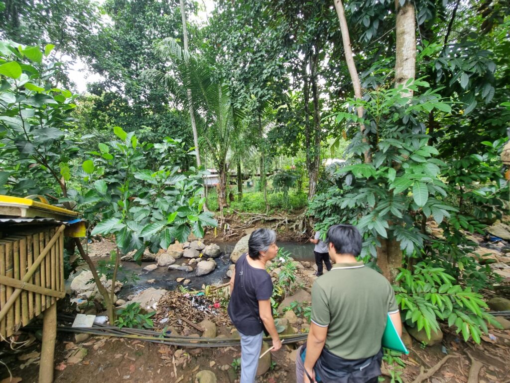
Transect walk at Nalumville
The workshops are designed as a multi-stakeholder forum presided by HOA officers. After a brief orientation on the RURBANISE objectives by ESSC and TAMPEI, the sessions transition into a strategic knowledge exchange. A critical part of the session involves understanding and connecting ‘top-down’ and ‘bottom-up’ perspectives, as localized coping mechanisms are presented alongside the broader disaster risk reduction management plans of local governments.
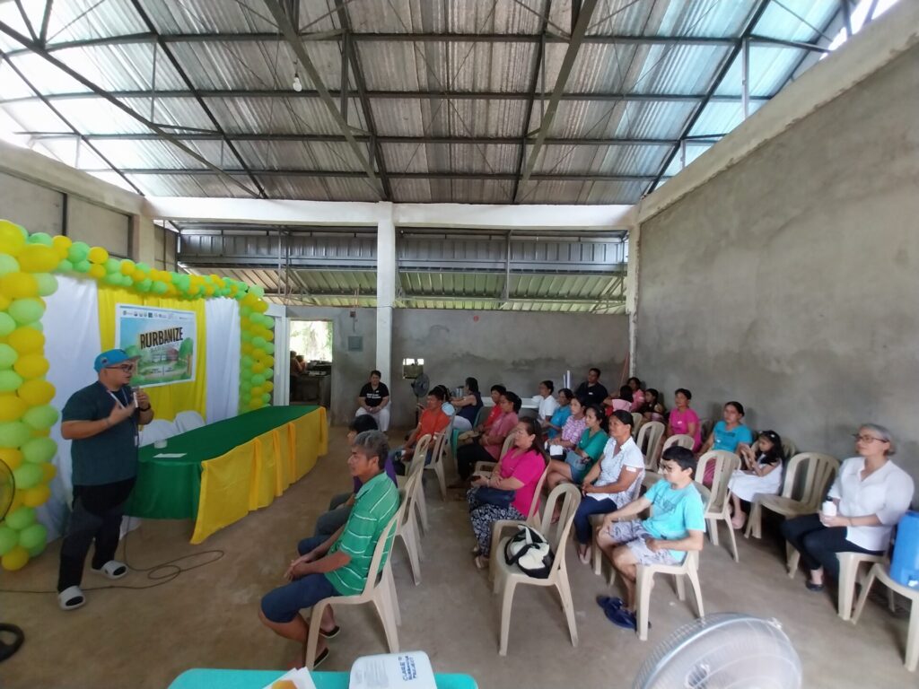
The workshops are divided into four modules: a) Hazard Reference Events, b) Mapping Exercise, c) Coping Strategies, and d) Socio-Organizational Arrangements.
The Resilience Spectrum
The seven RURBANISE sites share a common thread: the pursuit of long-term security in an unpredictable climate.
The CVCA workshops however revealed that while some communities grapple with surviving rising waters, the other communities with safer areas focus on sustaining their safety.
There is no ‘one-size-fits-all’ risk reduction solution. Instead, a nuanced roadmap is revealed where every community, regardless of their current hazard level, has a specific contribution in the landscape of urban resilience.
ESSC divided the communities into five clusters: 1) Flood-Prone, 2) Erosion-Prone, 3) Safe and Strong, and 4) Safe but Needing Re-Engagement, and 5) Need to Re-Build.
The Front Line: Flood-Prone Communities
For ULHOA (Valenzuela), Nalumville (Davao), KABALAKA (Iloilo), and SMASH (Mandaue), flooding is a common environmental and social risk. Situated in low-lying floodplains, in riversides and meandering creeks and in coastal catch-basins, these communities are along waterways with some located in the “final destination” for their respective watersheds. Their primary challenge is to get out of harm’s way during extreme rainfall events when flooding and landslides are imminent.
However, the “differentiated reality” within this cluster reveals that the problem is not about rainfall but how people and the built environment interacts with the hydrological flow:
- The Infrastructure Traps
In the industrial and high-density corridors of Valenzuela and the compromised relocation site in Mandaue, natural drainage systems are significantly compromised by rapid urbanization. For communities like ULHOA and SMASH, resilience is hindered by “infrastructure traps” such as raised roadways and industrial blocks that impede the flow of floodwaters, a problem worsened by poor garbage disposal and lack of drainage. Furthermore, these densely-populated sites face the threat of the Urban Heat Island (UHI) effect, which elevates the risk of fire.
In ULHOA, survival strategies are centered on asset protection and internal relocation to higher elevations, and rebuilding efforts that prioritize fire-proofing. For the SMASH community, adaptation means evacuation preparedness, information dissemination for early warning and managing the waters from the river and from the city canal beside the housing site.
- The Watershed Recipients
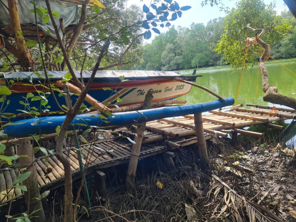
In Nalumville and KABALAKA, the risk is defined by their “downstream” status, being situated in proximity to three creeks and a river respectively. For the residents of Nalumville, survival is a shared responsibility. This community is most at risk as the houses are located along meandering creeks that in extreme rainfall events can develop flash floods that can wash away the houses completely. Their coping mechanism is centered on community-wide awareness of climate threats and organized cleanups. Meanwhile, KABALAKA demonstrates a high degree of technical resourcefulness; residents proactively deploy ‘flood-proofing’ measures, such as improvising traplines and erecting trampas (bridge). These localized structures are essential lifelines that allow the community to navigate inundated streets and protect homes from the Batiano River’s overflow.
The Shifting Ground: Erosion-Prone Site
In APSHAI (Montalban, Rizal), the resilience challenge is defined by its topography r. While the community’s high elevation reduces the risk of flooding, this same terrain has a critical vulnerability, soil erosion that can lead to landslides during rainfall events.
The APSHAI community emerged from previous residents at the Payatas dumpsite in Quezon City who relocated to a three-hectare property acquired through community savings following a tragic landslide in 2000 that claimed over 200 lives. Given the site’s steep elevation, slope stability and landslide susceptibility are primary concerns for the residents. This sloping terrain also presents significant structural challenges for housing construction. Furthermore, establishing consistent access to potable water and a reliable electricity supply remains a continuous challenge for the community.
APSHAI strengthens its resilience through targeted mitigation efforts. By institutionalizing proactive steps like roof maintenance and drainage clearing, the community ensures that its infrastructure remains robust and its pathways for water remain unobstructed, directly reducing the likelihood of property damage during extreme weather.
The Resilience Blueprint: Safe and Strong Community
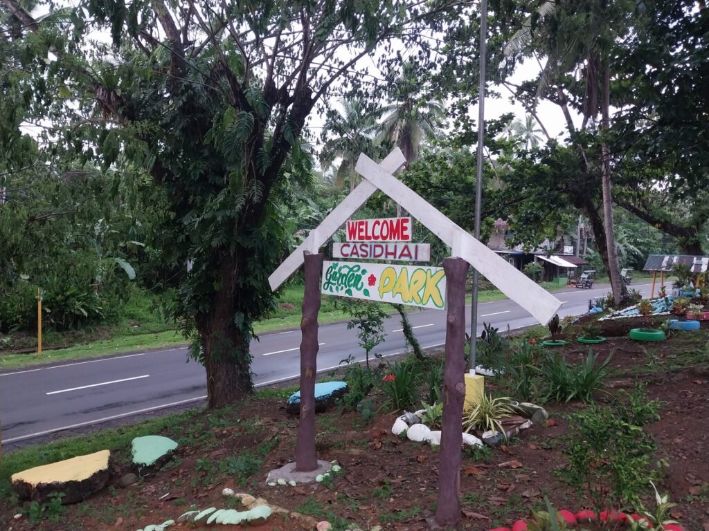
The CASIDHAI community in Camarines Norte is in an upland rura area and established in 2014 for families displaced from the town center by road widening, local insurgencies, and proactive resettlement from disaster-prone areas. The community acquired an-eight-hectare relocation site that is generally safe from flooding but with steep slopes.. At the moment, only 17 of the 255 members currently reside in the site due to the significant financial investment required for housing construction. Consequently, flooding remains a critical concern for offsite members, particularly those still situated in high-risk areas.
With the community about an hour from the town center, immediate access to critical services is limited, such as medical facilities during emergencies. However, the site is equipped with basic infrastructure, including paved roads, a multi-purpose covered court, and a dedicated evacuation center that government agencies provided in coordination with the barangay.
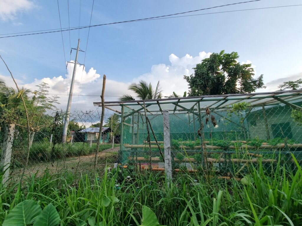
Several members maintain agricultural land for rice and coconut farming, while others are engaged in fishing. Onsite, the HOA is active in developing livelihood opportunities and maintains partnerships with the private sector and government agencies for citronella and soap production, virgin coconut oil processing, and livestock poultry initiatives, including cattle and poultry. Furthermore, Labo’s natural landscape and fresh water sources , present significant potential for ecotourism as a sustainable income source.
The adaptive capacity of the community is driven by disaster protocols and local coordination. Key strengths include an active partnership in barangay-level DRRM, a clear and actionable evacuation plan, and the implementation of preventative measures aimed at reducing disaster-related vulnerabilities.
The Untapped Potential: Safe but Needs Re-Engagement
Resilience extends beyond mere physical protection from hydro-meteorological hazards like flooding and landslides. For HOA 1 in Kidapawan, Cotabato, building adaptive capacity is an exercise in multi-stakeholder engagement, requiring active collaboration with the local government and supporting organizations. To reflect this, the CVCA workshop methodology was specifically tailored to address the unique institutional landscape and evolving needs of this community.
The relocation history of HOA 1 is marked by a gradual transition that began in 2002. Although only 30 of the 136 member households currently reside onsite, the community maintains a low profile with the local government. Despite this being a fraction of the total membership, city officials were largely unaware of the community’s presence, as revealed during the CVCA workshop.
Currently, the pioneering residents are developing community gardens and open spaces to incentivize the remaining offsite members to begin construction.
The overall location is categorized as generally safe from climate-related hazards. Hazard assessment data confirm that the site is safe from storm surges. While it remains partly susceptible to flooding, its risk level for rain-induced landslides is classified as least to moderate, suggesting manageable geological vulnerabilities. However, the residents identified four critical infrastructure gaps: 1) issues in water access, 2) land encroachment and residential proximity to high-voltage transmission posts, 3) poor drainage system, and 4) limited power connections for electricity.
The association is actively seeking strategic collaboration with the city government, encouraged by a perceived institutional openness toward community-led partnerships.
The Fragile Foundation: Need to Re-build
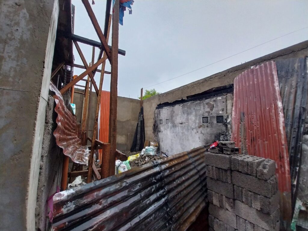
During the preparatory consultations, it became evident that two partner communities face critical, non-climate-related threats that required immediate attention. Smart Tower (Muntinlupa City), situated within the compound of the New Bilibid Prison, was navigating an imminent eviction threat and tenure insecurity. Meanwhile, the ASHAI community (Talisay, Cebu) suffered a devastating fire in March 2024 damaging 125 houses, mere days before the scheduled workshops. Recognizing these urgent crises, the team deferred the standard CVCA workshops in favor of specialized situational assessments to better understand the communities’ changed priorities.
Despite these challenges, hazard assessments were conducted for both sites. Regarding hydro-meteorological hazards, data from Project NOAH indicate that SMART Tower is safe from flooding, landslides, and storm surges. However, MGB data classifies the area as having least susceptibility to rain-induced landslides due to the community’s elevated, hilly topography. Conversely, while ASHAI’s immediate priority remained post-fire recovery, its hazard assessment reveals significant environmental risks; the site is characterized as highly susceptible to flooding and storm surges during intense tropical cyclones due to its low-lying coastal location, though it remains safe from landslide hazards.
| Cluster | Site Name | Background Summary | Watershed Profile | Hazards Assessment | Vulnerabilities | Capacities |
| FLOOD-PRONE | ULHOA (Valenzuela City) | An onsite housing project with 350 households in a highly industrial area. Residents settled in the 1980s and gained legal ownership in 2015. | Part of the Bulacan Watershed. It is located 480m south of the Meycauayan River with an average slope of 10%. | Safe from landslides and storm surges, but is susceptible to flooding. | Vulnerable due to poor sanitation, and lack of updated evacuation plans, unsafe physical locations exacerbates flooding as rainwater flows down from the main road toward the northern boundary of ULHOA, where water accumulates due to its low elevation, presence of factory walls, and lack of proper drainage; use of light construction materials; lack of fire exits and congested housing. | Coping strategies involve: -Strong HOA: organized, active, proactive HOA leaders; home address plates for security of tenure; collective community action (tulong tulong and bayanihan) -Strong relationship with LGU and willingness to partner with NGOs; -Re-blocking intended to improve poor drainage of the community and reduce flooding in the are |
| FLOOD-PRONE | SMASH (Mandaue City) | A relocation site for 12 associations under a city-managed project. Members were formerly relocated from “high-risk” river areas. However, the relocation site is identified as flood prone by the city government and considered as a catch basin. | Part of the Butuanon Watershed. Flat topography (1–3 masl) located downstream near the shore. | Safe from landslides, but is highly susceptible to flooding and storm surges during strong tropical cyclone events due to its location in a low-lying area near the shore and downstream of Butuanon River. Also faces fire risksdue to high density. | Vulnerable as the whole HOA is flood-prone (overflowing river, poor drainage), including the evacuation site and surrounding roads. Evacuation site not only unsafe but also insufficient. | Capacity includes evacuation preparedness, information dissemination, and rebuilding efforts that prioritize fire-proofing. |
| FLOOD-PRONE | Nalumville (Davao) | A community composed of 150 famillies relocated from Barangay Dumoy due to issue of road right of way. Unfortunately, the relocation site was not assessed pre-purchase revealing eventually that area is nestled in a riverbed of three creeks. | Part of Talomo Watershed. Gently sloping, elevated area. Transected by a creek and bounded by two other creeks in northern and southern areas. | Safe from landslides and storm surges, but is moderately to least susceptible to flooding. | Vulnerabilities include: -Located beside meandering creeks that overflow during heavy rains and prolonged rainfall events which makes the area a danger zone and not really suited for residential purposes -The physical location coupled with insufficient disaster preparedness, poor drainage systems, unmaintained bridges, garbage mismanagement, and lack of institutional support make community more vulnerable to natural hazards. -Does not have a strong relationship with brangay/city; need city support for them to have any realistic improvement when it comes to flooding -No proper evacuation plan (just go to second floor) or disaster plan | Coping mechanisms are centered in community awareness and participation. |
| FLOOD-PRONE | KABALAKA (Iloilo City) | Formed in 1996 after coastal evictions. A pilot site for community-led infrastructure finance (CLIFF) with 76 members. | Part of the Tigum-Aganan Watershed. A flat area only 1 meter above sea level, adjacent to the Batiano River. | Safe from landslides, but is highly susceptible to flooding and storm surges during strong tropical cyclone events. Also faces risks from land subsidence due to groundwater extraction. | Vulnerable due to: -Highly susceptible to flooding – no drainage, overflow of Batiano river (flooding is surface run off), the river flows upstream during high tide and downstream during low tide, which plays a large role in the flooding situation in KABALAKA. -Garbage is a big problem (lack of system for sorting and collecting garbage). -Easement not followed- community hall is within the easement, informal settlers are also an issue. -Saltwater intrusion in drinking water. | The community adapts to typhoon risk by improvising traplines, CHB walls, and trampa (bridge). |
| EROSION-PRONE | APSHAI (Montalban, Rizal) | Formed by former scavengers from the Payatas dumpsite after the 2000 trash slide. A peri-urban settlement with 382 households on 3 hectares. | Part of the Puray Watershed (Marikina Watershed). Situated in an elevated area (35–83 masl) with steep slopes (up to 49%). | Safe from flood and storm surge hazards, but moderately susceptible to landslides. Prone to destructive ground shaking from the Valley Fault System. | Vulnerability due to light-material houses and lack of safety measures. | Capacity includes proactive steps to reduce damages suchas roof maintenance and drainage cleanup. |
| SAFE AND STRONG COMMUNITY | CASIDHAI (Labo, Camarines Norte) | A rural community formed in 2014 for families displaced by road widening and insurgencies. Strong partnership with local government. | Part of the Labo Watershed. The site is gently rolling to undulating (70–120 masl). | Safe from storm surges, but is moderately susceptible to landslides and partly susceptible to floods. | Vulnerabilities: -being located beside roads that are prone to flooding and landslides -may stem from surrounding areas being affected by an event and impacts their access to it (like access to hospital/main roads/etc.); community is located about one and a half hours away from the town center which makes it hard to access life-saving services in emergency situations (i.e., hospitals). -Their underdeveloped rural community heightens exposure to environmental hazards, especially rain-induced landslides; most members are off-site (only 15 out of 285 are living on site) | CASIDHAI has several strengths to leverage on including a strong relationship with the barangay, clear plans in the event of disaster, and a strong leadership in their community. |
| SAFE BUT NEEDS RE-ENGAGEMENT | HOA 1 (Kidapawan, Cotabato) | A community with a 1.5-hectare land with only 30 out of 136 members reside onsite. | Part of the Saguing Watershed. The site has a 9% average (204-2011 masl). | Safe from storm surges, partly susceptible to flooding, and least to moderately susceptible to rain-induced landslides. | Identified concerns include: issue in water access, land encroachment and residential proximity to high-voltage transmission posts, poor drainage system, and limited power connections for electricity. Opportunities open for strategic collaboration with the city government | |
| NEED TO RE-BUILD | Smart Tower (Muntinlupa City) | Established in 2011 within the New Bilibid Prison reservation. It consists of 25 households facing land tenure insecurity on DOJ-owned land. | Part of the Muntinlupa Sub-basin of the Laguna de Bay Watershed. Located in an elevated, hilly area (37–50 masl). | Safe from flood, landslide, and storm surge based on Project NOAH data, but is least susceptible to rain-induced landslides based on MGB data due to the community’s location in an elevated, hilly area. | The main concern of the community is their land tenure situation. | |
| NEED TO RE-BUILD | ASHAI (Talisay, Cebu) | A coastal community formed in 1990 with a total of 150 members within 0.26 hectare of privately-owned land. Suffered a massive fire in March 2024 that destroyed 125 houses. | Part of the Bulacao Watershed. Low-lying flat coastal area (2 masl) located just 30m from the shoreline. | Safe from landslides, but is highly susceptible to flooding and storm surges during strong tropical cyclone events due to its location in a low-lying coastal area. | Vulnerability was evident in the aftermath of the fire incident. |
The Next Steps
The Community Vulnerability and Capacity Assessment (CVCA) workshop, a core participatory element of the RURBANISE project, provided a vital venue for the communities to transform post-disaster experiences into a structured analysis of local risks. Moving forward, these insights would be integrated with flood model simulations and household surveys to develop a comprehensive understanding of “differential vulnerability.” This data-driven approach ensures that the project accounts for how the unique intersection of urbanization and geography affects each community differently.
At the institutional and local levels, the focus shifts toward actionable validation and organizational strengthening. The team would revisit each site to validate findings and provide targeted support for the immediate action points identified by residents, ensuring that the transition from assessment to implementation is both community-led and sustainable. Moreover, the results would be a critical element in HPFPI strategic plan review, addressing the need for internal leadership re-orientation to build more resilient social structures.
As Project RURBANISE moves from assessment to implementation, the goal remains clear: to ensure that every partner community—whether on the flood-prone front lines or the shifting ground of relocation—has the structural and social foundation to thrive in an era of urban uncertainty.
—
CLARE is a £110m, UK-Canada framework research programme on Climate Adaptation and Resilience, aiming to enable socially inclusive and sustainable action to build resilience to climate change and natural hazards. CLARE is an initiative jointly designed, funded and run by the UK Foreign Commonwealth and Development Office and Canada’s International Development Research Centre. CLARE is primarily funded by UK aid from the UK government, along with the International Development Research Centre, Canada.
The UK is the majority funder of the initiative, providing 85% of the ‘CLARE Research’ funding and funding CLARE Services and Partnerships. Canada provides 15% match-funding towards CLARE Research and is its main delivery partner. Both organisations work closely to set the strategic and technical directions of the initiative.
This blog was initially published on the TAMPEI website: https://www.tampei.org/post/watersheds-and-workshops-the-science-of-community-resilience
Categories
Countries
CLARE Pillars
CLARE Themes
CLARE Topics
Published
CLARE Projects
CLARE Partners