
Story of Change: Informing climate-resilient infrastructure planning in Beira, Mozambique
Published on
Authored by Eduardo Mondlane University (UEM), ICLEI Africa, Beira Municipality
What changed?
In Beira, a coastal city in Mozambique, the INACCT Resilience project has provided the municipal government with a robust, upgraded evidence base designed to inform its “Planos de Pormenor” in INACCT’s target neighbourhoods. Once funding is secured, these detailed, neighbourhood-scale planning instruments will translate broader municipal resilience strategies into targeted local actions, focusing on reducing specific flood vulnerabilities, improving roads and drainage, regularizing land tenure, and supporting safe building standards. Crucially, having this co-produced data already in place gives the municipality an objective foundation to actively apply for the funding necessary to implement and upscale this inclusive approach.
Whereas previously the groundwork for these plans would have relied on generic, top-down municipal assessments, this new evidence base was co-produced directly with community members, community-based organizations, and other local stakeholders in Ndunda, Alto da Manga, and Mungassa. This collaborative process successfully identified the concrete, highly localized gaps, such as specific needs for bridges, emergency shelters, and targeted drainage networks that urban planning must address to strengthen resilience to climate shocks where vulnerability is greatest.
“The most notable inputs to this work came from local communities, as they knew which areas were regularly flooded.”
– Interview with a Beira Municipality technical partner, CLARE program evaluation
Why does it matter?
Flood-risk evidence is most effective when it is rooted in local realities, reaches the people most exposed to climate risk, and inspires the trust needed to spur action. The use of localized and co-created evidence is helping Planos de Pormenor avoid being generic planning instruments, to instead ensure that the specific vulnerabilities and priorities of residents are addressed. These detailed neighbourhood plans are anchored in the actual landscape of risk and address both the current and anticipated future needs of residents.
This is particularly important in Beira, where much of the city sits at or below sea level along a river delta and is increasingly exposed to climate hazards such as flooding due to intensifying tropical cyclones, storm surges, heavy rains, and coastal erosion. Meanwhile, approximately 70% of Beira’s population of more than 600,000 people lives in growing informal settlements, which face unique and insufficiently evidenced infrastructure needs in the face of these climate-related stressors.
By working directly with the municipality and affected communities, INACCT’s approach to research helped bring both the local specificity of evidence needed to strengthen the resilience of these neighbourhoods and the relational trust required to ensure that evidence is used by decisionmakers.
What did CLARE do to contribute?
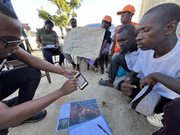
By working directly with municipal authorities and community organizations in the neighbourhoods of Ndunda, Alto da Manga, and Mungassa, the INACCT team generated neighbourhood-scale evidence that cannot be captured by top-down assessments alone. The research team conducted focus groups, a socio-economic climate vulnerability survey, participatory mapping workshops, and field verification of satellite and municipal flood risk data. INACCT also supported the improvement of community evacuation maps, stress-tested flood risk scenarios, and community-validated remotely sensed data against lived experience. Crucially, through a collaboration with the REPRESA project led in Mozambique by the Eduardo Mondlane University (UEM), joint Learning Lab sessions were facilitated to operationalize climate research findings, co-produce localized climate storylines, and evaluate community-based early warning systems. A photovoice exercise, in which community members themselves documented climate risks through photography, produced some of the most direct imaging of how flooding and infrastructure failure are actually experienced by residents of informal settlements.
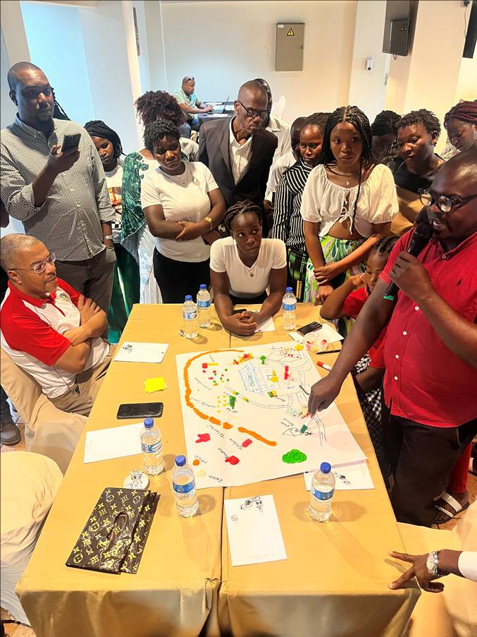
Central to this research was an intentional focus on strengthening the capacities of both municipal and community partners in Beira, and on embedding a gender equality and social inclusion (GESI) approach throughout the process. To operationalize these capacities, a practical training workshop on Geographic Information Systems (GIS), open data, and urban risk mapping was organised by UEM and University of KwaZulu Natal, and conducted for municipal officials, Disaster Risk Reduction officers, and academics. By involving those best placed to use and benefit from evidence directly in the research, INACCT not only generated new and more inclusive knowledge, but also strengthened capacities to put evidence into action, including through the Planos de Pormenor.
About INACCT
The Designing Inclusive African Coastal Cities project (INACCT Resilience) works in coastal cities Mozambique and South Africa to support municipalities and vulnerable communities in informal settlements and flood-prone areas to co-design gender-responsive and inclusive resilience approaches.
Learn more:
Categories
Countries
CLARE Projects
CLARE Pillars
CLARE Themes
CLARE Topics
CLARE Partners